If you have ever opened Waze and wondered, “Where is the button that shows every local report around me?” you are not alone. Waze is famous for its community-powered road alerts: crashes, police sightings, construction, potholes, cars on the shoulder, traffic jams, closures, bad weather, and those mysterious “object on road” warnings that make every driver briefly imagine a sofa in the fast lane.
But here is the important truth: Waze does not currently work like a traditional “local reports dashboard” for everyday drivers. There is no single tab that displays every report in your city as a neat list. Instead, Waze shows local reports through the live map, route alerts, map icons, pop-up warnings, and alert settings. In other words, Waze wants you to see what matters near your drive, not scroll through a giant incident feed like you are reading traffic gossip over coffee.
This guide explains how to view all local reports on Waze as completely as the app allows, how to make more alerts visible, how to use Waze Live Map before you leave, and how to avoid missing important local road information.
What Are Local Reports on Waze?
Local reports on Waze are real-time road updates submitted by drivers, map editors, and partner sources. These reports help Waze warn other users about conditions that may affect safety, speed, or route choice. Common Waze reports include:
- Traffic jams and sudden slowdowns
- Crashes and vehicles stopped on the shoulder
- Police reports and speed enforcement alerts
- Construction, roadwork, and lane closures
- Potholes, objects on the road, broken traffic lights, and other hazards
- Weather-related conditions such as fog, flooding, ice, or poor visibility
- Map chats, closures, cameras, road features, and high-risk areas where available
The phrase “local reports” usually means alerts near your current location or along the route you are driving. Waze uses these reports to improve ETAs, suggest reroutes, and give drivers a heads-up before trouble appears through the windshield. That is the magic of Waze: it is not just a map; it is a crowd-powered early-warning system with a steering wheel obsession.
Can You View All Local Reports on Waze?
The honest answer is: mostly, but not in one perfect list. Waze does not provide a simple “View All Local Reports” button for regular app users. You can view reports by looking at the map, zooming around your area, planning a route, checking alerts along your drive, and using the Waze Live Map on desktop or mobile browser.
This design makes sense when you think about how Waze is used. Most people open Waze while driving or preparing to drive. A huge list of every report nearby would be distracting and, frankly, a little chaotic. Instead, Waze prioritizes the alerts most relevant to your route, your direction, your distance from the event, and the type of road condition being reported.
So, when people ask how to view all local reports on Waze, the best practical answer is: use a combination of map view, alert settings, route preview, and Waze Live Map. Together, these give you the widest possible look at local reports without needing a separate incident-feed feature.
How to View Local Reports in the Waze App
1. Open Waze and Look Around the Map
The simplest way to see local reports is to open Waze and check the map around your current area. Report icons appear directly on the map when relevant alerts are active and visible. These icons may represent crashes, hazards, traffic, police, construction, closures, cameras, or other road conditions.
You can pinch to zoom out and drag the map to nearby streets, highways, or neighborhoods. If reports are available and your alert settings allow them to appear, you should see icons placed near the affected road segments. Tap an icon when possible to view more detail, such as the type of report or whether other drivers have confirmed it.
For example, if you are leaving downtown at 5:30 p.m., zooming out may show traffic reports on the main highway, a crash on an alternate road, and a construction alert near an exit ramp. That gives you a quick local traffic snapshot before you start moving.
2. Start a Route to See Reports That Matter Most
Waze becomes much more useful once you enter a destination. When navigation is active, Waze focuses on reports along your route and can warn you before you reach an incident. This is the best way to see the local reports that actually affect your drive.
To do this:
- Open the Waze app.
- Enter your destination in the search bar.
- Choose your route.
- Review the map before tapping drive, or begin navigation and watch for alert icons and pop-ups.
Route-based viewing is especially helpful because not every local report matters. A pothole three blocks away on a side street may be interesting, but a crash two miles ahead on your route is the kind of information that can save time, stress, and possibly your bumper.
3. Zoom Out Carefully, But Do Not Expect Every Report Forever
Waze reports are temporary. A report may disappear after a certain amount of time, especially if other drivers say the issue is “Not there.” Reports also depend on driver activity. A busy metro area may show many alerts, while a quiet rural road may show fewer reports simply because fewer Wazers are nearby.
When you zoom out, you may see more icons, but Waze may also simplify the map to avoid clutter. This is why “all local reports” is not always literal. You are seeing a filtered, real-time view based on location, zoom level, app settings, and active reports.
How to Turn On More Report Types in Waze
If you are not seeing many local reports, your alert settings may be limiting what appears on the map. Waze lets you customize what alerts you see and how you receive them.
Follow these steps:
- Open Waze.
- Tap the menu icon.
- Tap Settings.
- Tap Alerts and reports.
- Tap Reports.
- Select a report type, such as Police, Crash, Traffic, Hazards, Cameras, Closures, or Construction.
- Turn on Show on map if available.
- Turn on Alert while driving if you want voice or pop-up warnings.
This is one of the most important steps in learning how to view all local reports on Waze. If “Show on map” is off for certain report types, you may not see those alerts even when they exist nearby. Think of this setting as the difference between wearing glasses and trying to identify a traffic cone using vibes alone.
Understanding “Show on Map” vs. “Alert While Driving”
Waze separates visual alerts from driving alerts. This matters because you may want to see many reports on the map but hear only the most important warnings while driving.
Show on Map
When this setting is enabled, Waze can display that report type as an icon on the map. This is useful when you are checking local conditions before a trip.
Alert While Driving
When this setting is enabled, Waze may give you a voice alert or pop-up warning while you are driving. This is useful for high-priority conditions such as crashes, hazards, police, cameras, or major slowdowns.
However, Waze may still limit how many alerts you receive on a route. The app tries to reduce distraction by prioritizing alerts based on relevance, location, road familiarity, and other factors. Translation: Waze may decide that warning you about twelve different things in two minutes is not helpful unless your idea of fun is being yelled at by your dashboard.
How to Use Waze Live Map to View Local Reports Before Driving
Waze Live Map is one of the best tools for checking local reports before you get in the car. It is especially useful on a desktop or tablet because you can see a larger map area and plan your route more comfortably.
Here is how to use it:
- Open Waze Live Map in your browser.
- Search for your city, neighborhood, destination, or route.
- Zoom in on the area you care about.
- Look for traffic, incident, closure, or road alert icons.
- Click an icon to view available details.
Live Map is perfect when you are planning a commute, checking whether a closure affects your route, or comparing two possible drives. For example, before heading to the airport, you can search the area around the freeway, look for crash or closure icons, and decide whether to leave earlier. Your future self may thank you. Your coffee may not survive the trip, but at least you tried.
Why Some Reports Do Not Appear
If you cannot see all local reports on Waze, it does not always mean something is broken. Several normal factors can affect what appears.
Reports Expire
Waze reports do not stay on the map forever. A pothole, police sighting, stopped car, or object on the road may disappear after time passes or after enough drivers say it is no longer there.
Reports Depend on Other Drivers
Waze works best where many people actively use it. In a busy city, reports may appear quickly and often. On a quiet country road, fewer drivers means fewer reports. The app cannot show what nobody has reported.
Your Settings May Hide Certain Alerts
If report categories are disabled under Alerts and reports, you may not see them on the map. Check your settings regularly, especially after app updates.
Waze Prioritizes Safety
Waze may limit alerts while you are driving to reduce distraction. This is a good thing. You want helpful warnings, not a mobile game where every mile unlocks a new anxiety badge.
How to Report a Local Incident So Other Wazers Can See It
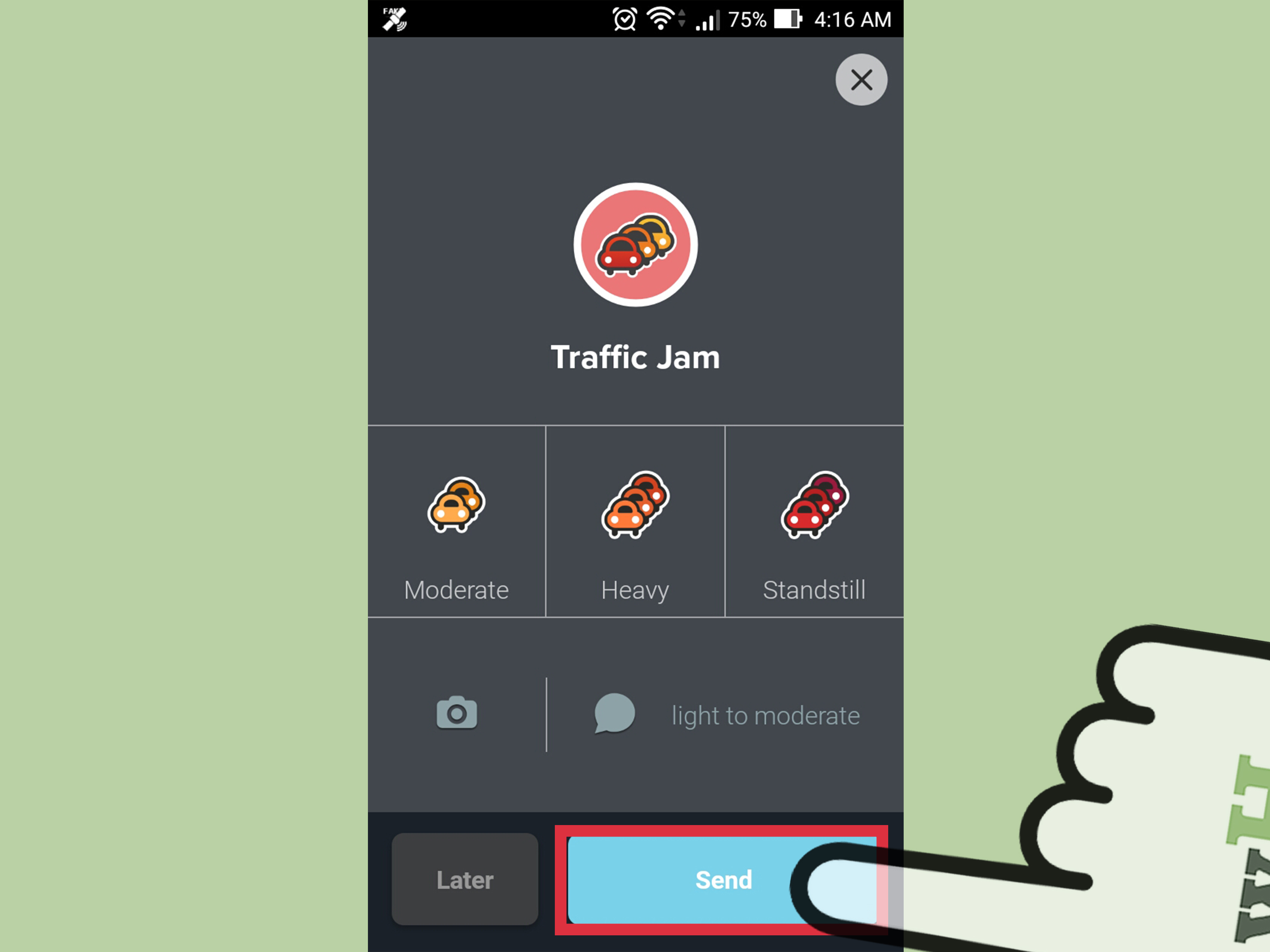
Viewing reports is only half the Waze experience. Reporting what you see helps other drivers. If you encounter a real-time hazard, traffic jam, crash, construction area, or stopped vehicle, you can submit a report.
Basic reporting steps usually work like this:
- Open Waze.
- Tap the report icon.
- Choose the report category, such as Hazard, Crash, Police, Traffic, or Closure.
- Select a more specific option if needed.
- Tap Report, or wait for Waze to send it automatically when supported.
Only report incidents you actually see in real time, and report as close to the real location as possible. Waze may save your report if your internet connection drops and submit it once you reconnect. Also, remember that your username can be visible on reports added to the map, so report responsibly. No fake potholes, no imaginary goats, and definitely no “traffic jam” reports because the drive-thru line was emotionally difficult.
Using Voice Features to Report Without Tapping Too Much
Waze has been improving voice-based reporting so drivers can report road conditions more naturally. In supported experiences, drivers can tap a reporting or voice option and describe what they see, such as “There is a pothole in the right lane” or “Traffic is stopped ahead.” Waze can interpret the report and add it to the map.
Some Waze users may also use Google Assistant commands, depending on device, region, language, and settings. Examples include commands such as “Report traffic,” “Report a crash,” “Report police,” “Report hazard,” “Report pothole,” or “Report construction.” Voice reporting is helpful because it reduces tapping, but it should still be used carefully. Your attention belongs on the road, not on composing a dramatic spoken memoir about a traffic cone.
How to See Reports on Android Auto, Apple CarPlay, and In-Car Systems
Waze can show alerts through Android Auto, Android Automotive, and Apple CarPlay, but the experience may differ from the phone app. If you want to adjust alert preferences for in-car use, change the settings on your phone first. In many cases, those preferences apply when Waze runs in your car display.
For the best experience:
- Update Waze on your phone.
- Check alert settings before connecting to the car.
- Enable the report types you care about.
- Use voice controls where supported.
- Set your route before driving, not while moving.
In-car Waze is excellent for seeing route-based alerts, but it may not be ideal for browsing all local reports across a wide area. For pre-trip research, the phone map or Waze Live Map is usually easier.
Best Practical Method to View the Most Local Reports
If your goal is to view as many local reports as possible, use this workflow:
- Open Waze and update the app if needed.
- Go to Settings > Alerts and reports > Reports.
- Turn on Show on map for important report types.
- Turn on Alert while driving for safety-critical alerts.
- Return to the map and zoom around your local area.
- Enter your destination to see route-specific reports.
- Use Waze Live Map for a wider pre-trip view.
This method gives you the closest thing to viewing all local reports on Waze. It combines app settings, visual map scanning, route intelligence, and browser-based planning.
Common Mistakes When Checking Waze Reports
Expecting a List View
Many users expect Waze to offer a local report list like “10 incidents near you.” That is not how the regular app is designed. Waze is map-first and route-first.
Forgetting to Start Navigation
If you only open the app without entering a destination, you may miss route-prioritized alerts. Starting navigation gives Waze more context.
Leaving Report Types Disabled
If you turned off camera, police, traffic, or hazard alerts months ago, you may forget they are hidden. Check your settings.
Assuming Every Report Is Still Accurate
Waze reports are community-based and time-sensitive. A police report may be gone. A crash may be cleared. A pothole, sadly, may still be living its best pothole life. Use reports as guidance, not absolute truth.
Final Thoughts: The Smart Way to View All Local Reports on Waze
Learning how to view all local reports on Waze really means learning how Waze thinks. The app does not hand you a complete incident spreadsheet. Instead, it gives you a living map powered by real drivers, local alerts, route-based warnings, and customizable report settings.
For the most complete view, turn on the report types you care about, scan the map, start a route, and check Waze Live Map before important drives. This approach helps you catch crashes, construction, closures, traffic jams, hazards, police reports, and other road conditions before they surprise you.
Waze is not perfect, but when used correctly, it can feel like having thousands of local drivers whispering helpful road secrets into your dashboard. Slightly weird? Yes. Extremely useful? Also yes.
Real-World Experience: What It Feels Like to Use Waze Local Reports
The best way to understand Waze local reports is to use them during a normal week of driving. Not a dramatic road trip through a thunderstorm, not a movie-style chase scene, just regular errands, commutes, school pickups, grocery runs, and the classic “I am only ten minutes away” journey that somehow takes twenty-seven minutes because traffic has a sense of humor.
One of the most useful experiences happens before leaving home. Open Waze, enter your destination, and pause for a moment before tapping drive. Look at the route. Are there red traffic lines? Any crash icons? A closure near the usual exit? This two-minute habit can change the whole mood of a trip. Instead of discovering the delay when brake lights appear ahead, you get a preview. That preview may help you choose a different route, leave earlier, or mentally prepare for a slower ride.
Local reports are especially valuable in places where conditions change quickly. Around downtown areas, stadiums, schools, shopping centers, and airports, one small incident can ripple through surrounding streets. A single lane closure near a bridge can make three alternate routes suddenly look like parking lots. Waze reports help you notice those changes faster because they come from people already there. It is like getting a message from the future, except the future is annoyed and sitting behind a delivery truck.
Another real-world lesson: not every alert deserves panic. Sometimes Waze shows a police report and nothing is there. Sometimes it warns about an object on the road, and the “object” is a flattened cardboard box that has already lost its battle with civilization. That does not mean Waze is useless. It means reports are human-powered, temporary, and imperfect. The smart move is to treat them as early warnings. Slow down, stay aware, and let the information help without letting it control your entire drive.
Waze local reports also teach drivers to become better contributors. After seeing how helpful a crash or pothole alert can be, you may feel more motivated to report real issues yourself. The key word is real. Report what you actually see, report it close to the location, and avoid over-reporting. A good report can help hundreds of drivers. A bad report just adds noise, and roads already have enough noise without digital confetti.
For longer drives, Waze reports are useful at three moments: before departure, during route changes, and near major exits. Before departure, they help you choose the best route. During the drive, they warn you about problems ahead. Near exits, they help you decide whether to stay on the highway or escape to local roads. This is where Waze feels different from a static map. It is not just telling you where the road is. It is telling you what the road is currently doing, which is often “testing your patience.”
The biggest practical takeaway is simple: make checking Waze reports part of your driving routine, not an emergency reaction. Set your alerts, use the map, check Live Map for important trips, and start navigation even when you already know the way. You may know the road, but you do not know the fresh pothole, the sudden slowdown, the construction crew, or the car stopped around the bend. Waze local reports fill that gap, one community update at a time.